Horizons Beta
Primary application: Adobe Flash 8, Adobe Photoshop
Language: Actionscript 2.0, XML
Client: In-house development
Status: Launch Horizons Beta
Experiments in location-based photography.
Born from a love of long-distance touring, Horizons is a fully dynamic location-based photo gallery displaying adventure photography within the context of its geographical location. Populated with over 50,000 map tiles custom processed from NASA’s Blue Marble project and raw LandSAT-7 data, Horizons covers the entire world down to 15m resolution with spatial regions that zoom in even closer.
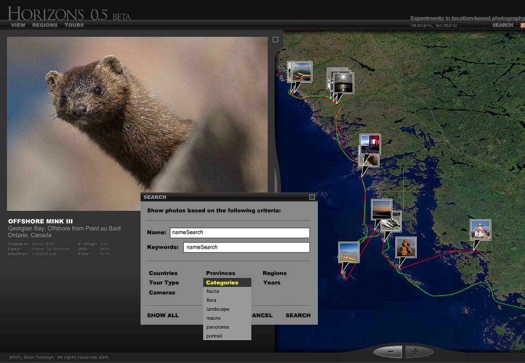
 Above: a fully dynamic search panel reveals different types of photography in Georgian Bay.
Featuring a fully scaleable and dynamic interface, Horizons can take advantage of everything that the largest displays have to offer. Powered by XML, adding photography, maps, and regions is as simple as changing a few lines of text — no modifications to the core Flash movie are necessary, so site updates are near-instantaneous.
 Using highly organized data structures, Horizons features full search functionality for keywords, countries, cameras, specific lenses, and more. And with the latest in Flash-javascript integration, Horizons is fully search engine optimized, enables the use of the forward- and back-buttons from the browser, and handles deep-linking effortlessly.


Leave a Reply